


ANTONIO RAIMO GALLERY
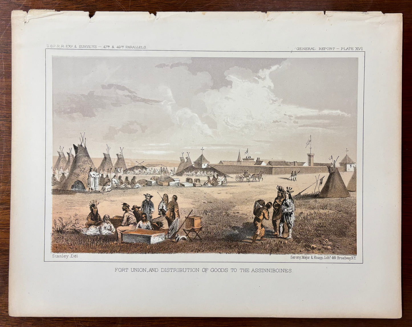
"Fort Union, and Distribution of Goods to the Assinniboines" by John Mix Stanley
"Fort Union, and Distribution of Goods to the Assinniboines" by John Mix Stanley
Couldn't load pickup availability
"Fort Union, and Distribution of Goods to the Assinniboines" by John Mix Stanley
C.1855
Hand-Painted Lithograph
In this 1855 hand-painted lithograph titled "Fort Union, and Distribution of Goods to the Assinniboines," a bustling frontier encampment scattered across a vast open plain serves as the expansive setting. Based on an original field drawing by the prominent Western artist John Mix Stanley, this print was meticulously produced by the famous New York lithography firm Sarony, Major & Knapp. The rich narrative scene features groups of Indigenous people gathering, conversing, and resting in the foreground alongside wooden crates, trunks, and trade goods. To the left, an array of traditional skin tipis stands prominently, while the fortified, walled compound of Fort Union with its distinct towers and flags dominates the right background under a sweeping, cloud-filled sky. The delicate tonal stone work and subtle watercolor tinting beautifully preserve Stanley's sharp ethnographic precision and mastery of frontier scale, finalized with lower margin printing text reading "Fort Union, and Distribution of Goods to the Assinniboines."
This composition belongs to a broader historical archive generated by the United States government during the mid-nineteenth century, where teams of scientists, engineers, and artists were commissioned to systematically map the uncharted territories of the American West. Published as Plate XXVI in the landmark multi-volume government document Reports of Explorations and Surveys, to Ascertain the Most Practicable and Economical Route for a Railroad from the Mississippi River to the Pacific Ocean, prints like this hold monumental historical importance because they document the foundational geological and cultural surveys of the expansionist era. By illustrating the treacherous pathways of the Northern Pacific Survey route managed under Governor Isaac Stevens, the print highlights the critical intersection of American infrastructure development, early frontier illustration, and the strategic cartography that reshaped the geography of North America.
Dimensions: H 9”x 11 ½”W
Condition: Some some small tears on the upper edge

-
Shipping
Share the details of your shipping policy.
-
Returns
Share the details of your return policy.
Image with text
Pair text with an image
Pair text with an image to focus on your chosen product, collection, or artist. Add details on availability, style, or even provide a review.
Image with text
Pair text with an image to provide extra information about your brand or collections.