


ANTONIO RAIMO GALLERY
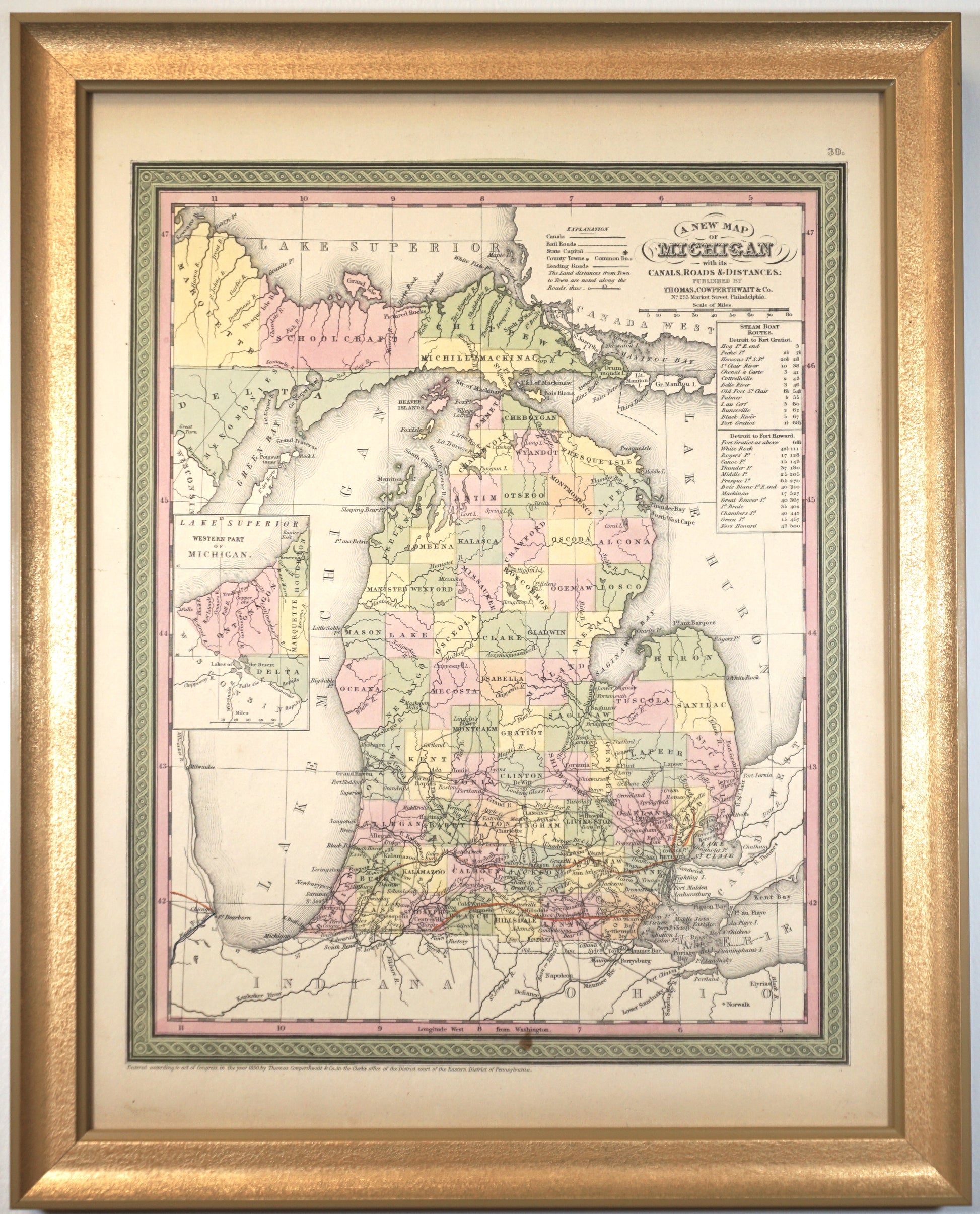
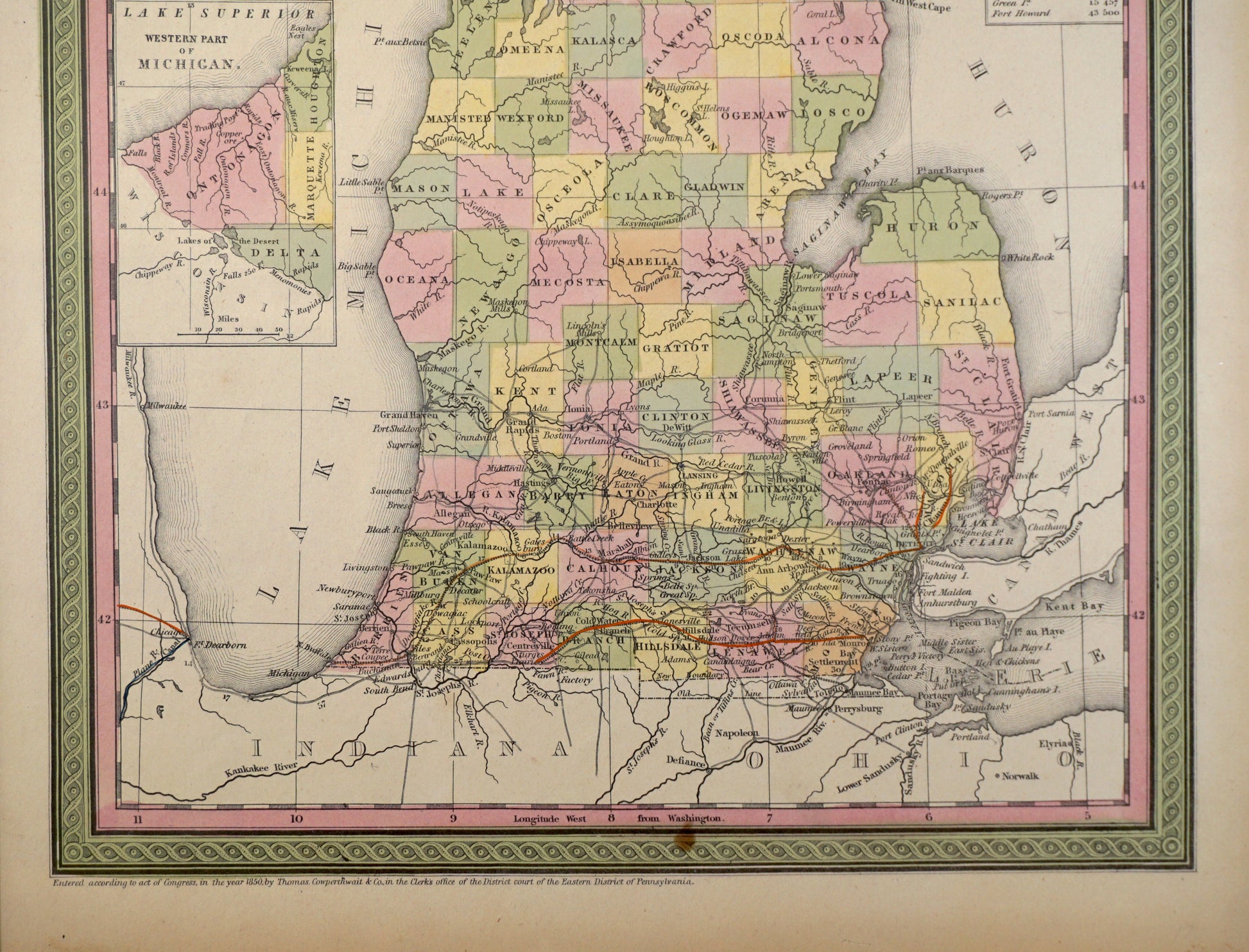
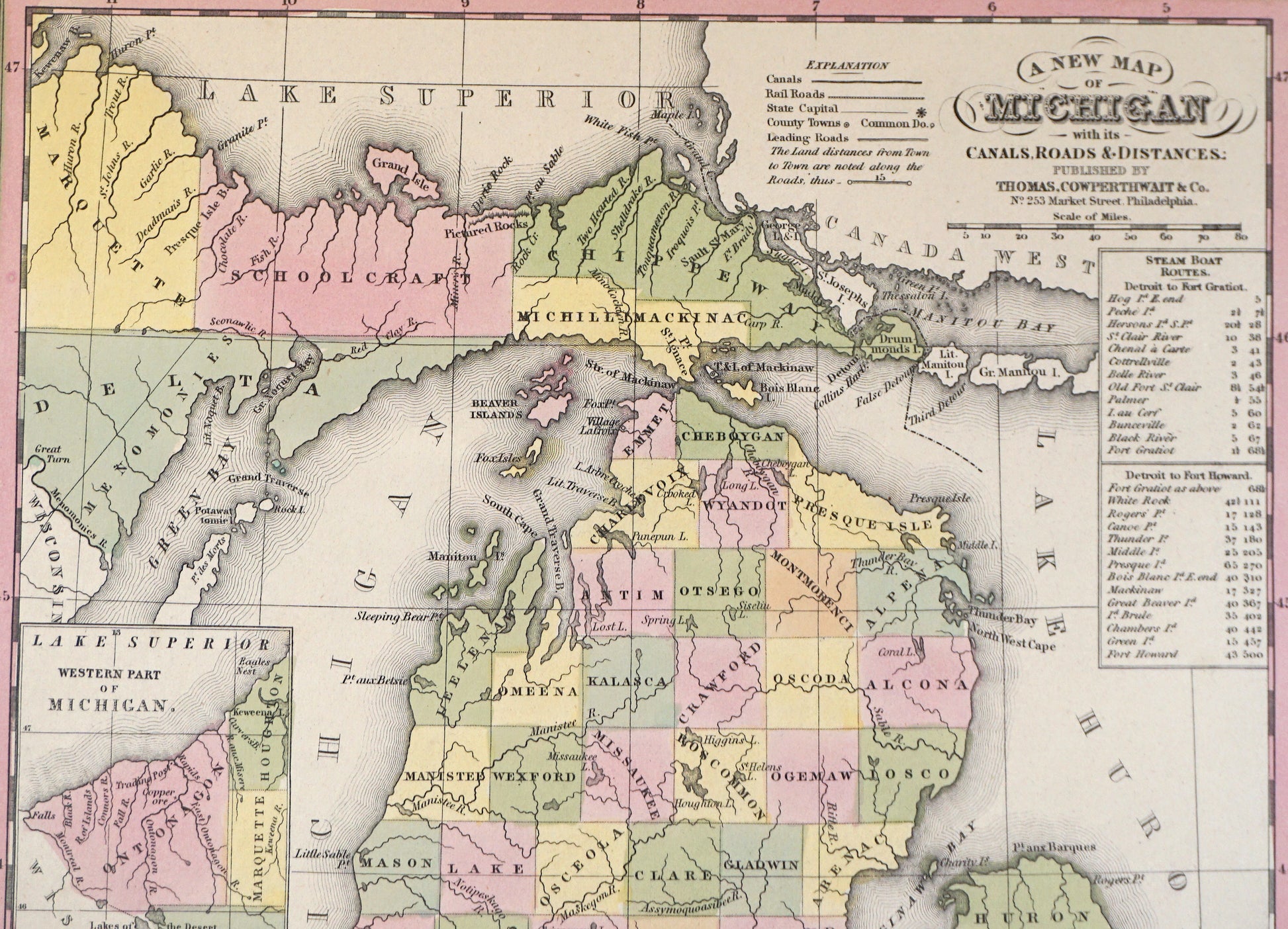
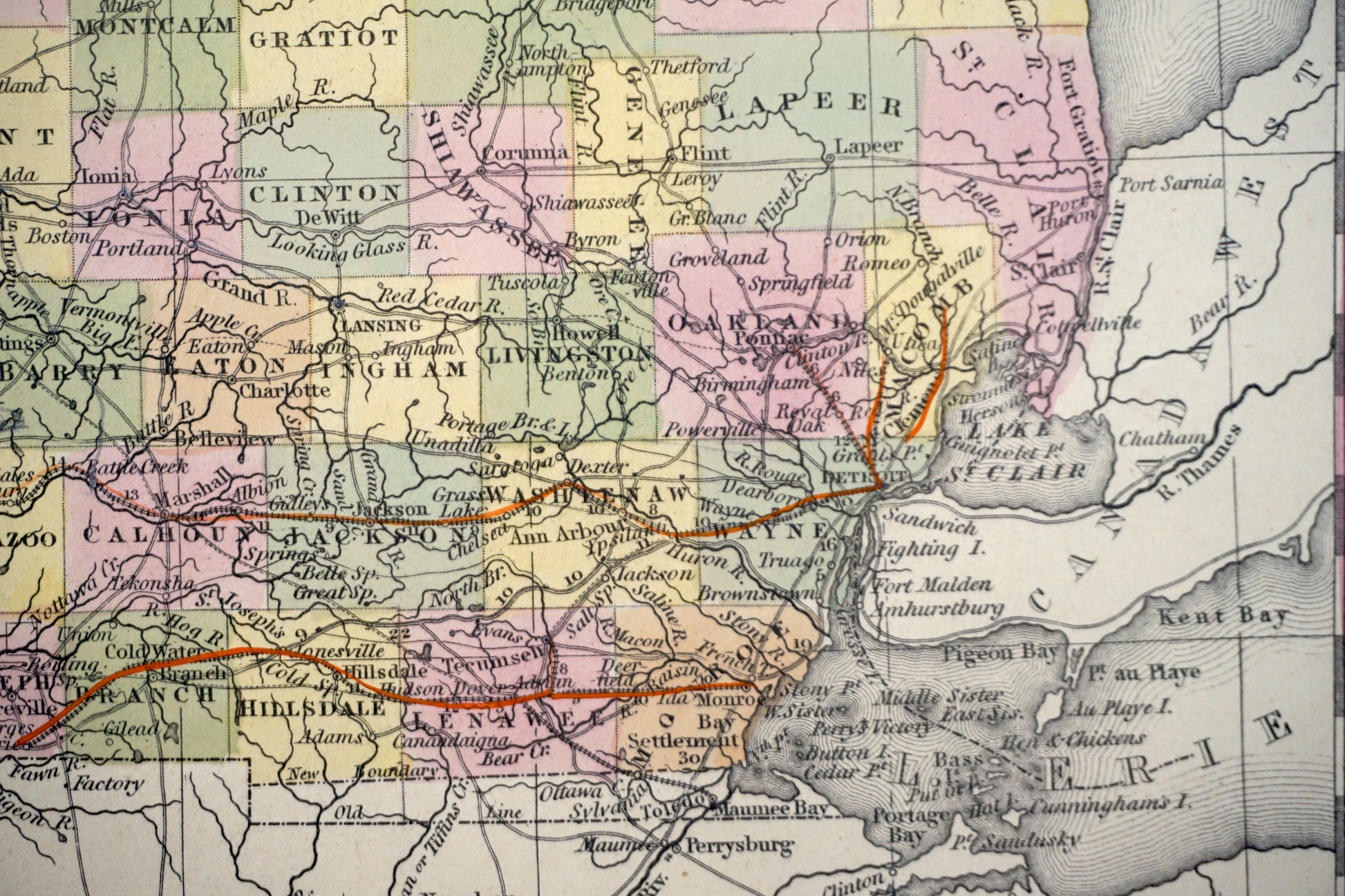
Original Antique Map of Michigan, 1850
Original Antique Map of Michigan, 1850
Couldn't load pickup availability
Original Antique Map of Michigan
Published 1850
Hand-colored Lithograph
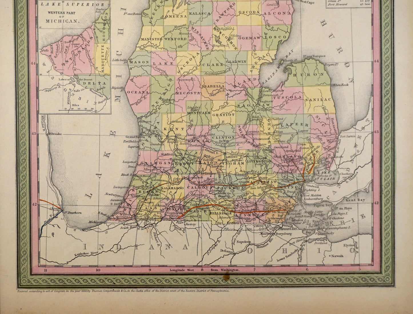
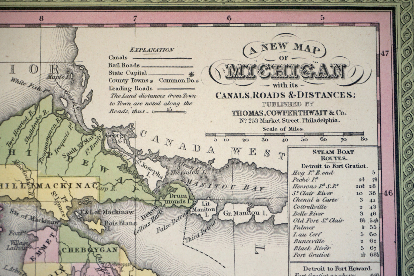
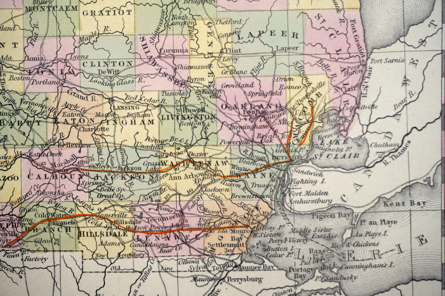
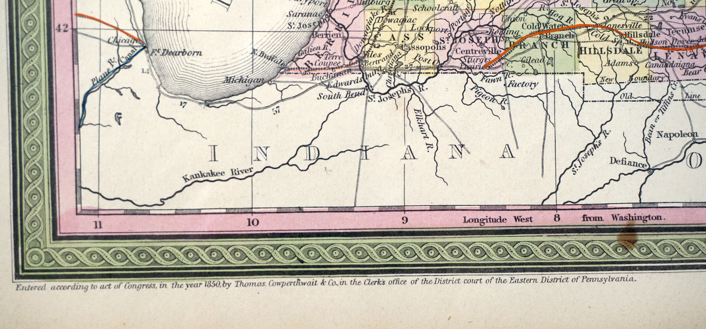
Published in 1850 by Cowperthwait and Co. in Philadelphia, this map has original hand-coloring. Fully titled "A New Map of Michigan with its Canals, Roads, and Distances," the map details transportation routes commonly taken throughout the state. The map is newly framed in a gold frame with glass.
Condition: Overall very good condition. One brown stain at the bottom center, otherwise the colors are vibrant and the paper is healthy.
Framed dimensions: 15 1/4" x 19" x 1"


-
Shipping
Share the details of your shipping policy.
-
Returns
Share the details of your return policy.
Image with text
Pair text with an image
Pair text with an image to focus on your chosen product, collection, or artist. Add details on availability, style, or even provide a review.
Image with text
Pair text with an image to provide extra information about your brand or collections.